Can You Hike the Entire Great Dividing Range? – Let’s get real for a second. The honest answer is that you can certainly tackle significant chunks of Australia’s longest mountain system on foot, but don’t go thinking there’s a single signposted trail that stretches all the way from one end to the other. Anyone who asks where is the great dividing range is mostly looking for a massive, fragmented backbone of mountains that requires smart planning, loads of patience and a willingness to piece together different journeys rather than follow some one-size-fits-all map.
I’m Paul Beames – and after years of leading trips, piecing together routes, and watching walkers come to an abrupt halt in the middle of a steep gully because they’ve changed their minds – I’ll put it bluntly: the Great Dividing Range isn’t about trying to cover 3,500 kms. It’s about picking the best parts and walking them properly.
Contents
- 1 The Reality of the Range
- 2 Why You Can’t Just Follow One Trail From End To End
- 3 The Trail Systems That Let You Go Long
- 4 New South Wales to Queensland: Plateaus and Passes
- 5 Wildlife, Weeds and the Reality of Track Infrastructure
- 6 How The Real Walkers Link The Range Together
- 7 Planning Realities You Just Can’t Ignore
- 8 The Takeaway From Someone Who’s Been There
- 9 FAQ
The Reality of the Range
The Great Dividing Range stretches some 3,500 kilometres from the far north of Queensland right down as far as New South Wales and Victoria – and it doesn’t stop there: that range continues into Tasmania, where it’s closely linked up with other high country. But here’s the thing – it’s not just one single, straight ridge – it’s a convoluted mess of plateaus, escarpments, valleys and high country that completely changes character every few hundred kilometres.
So when you’re trying to figure out where the great dividing range is, you can’t expect some tidy answer – one day you’re climbing rainforest spurs in Dorrigo National Park, the next you’re out on the snowgrass plains of Mount Kosciuszko National Park. Same mountain system, completely different demands.
Why You Can’t Just Follow One Trail From End To End
Unlike those world-famous thru-hikes in other countries, Australia’s Great Dividing Range has some very good reasons for not having a single, straightforward trail that you can follow from top to bottom. For a start, the range crosses multiple states, private farmland – where access rules can be a minefield – and Aboriginal country with very specific rules about who gets to walk where. And even if you do manage to navigate all those obstacles, there are also national parks that are closed off at certain times of the year. It’s a recipe for disaster if you try to follow some fantasy trail that you’ve found online.
And that’s exactly where people fall over – they chase some dream route that they’ve come up with, rather than trying to build a realistic plan based on what’s actually possible.
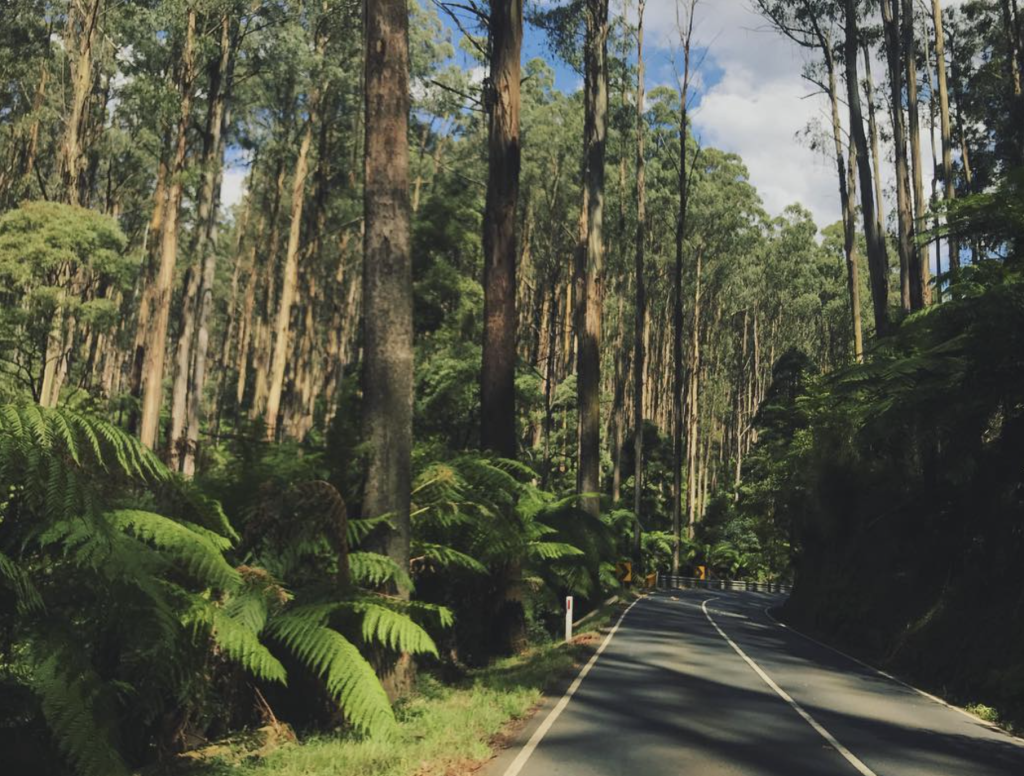
The Trail Systems That Let You Go Long
Victoria leads the way with a network of routes that follow or shadow the range like a loyal companion.
The Tracks of Goldfields and the Western Ranges
The 210-kilometre Goldfields Track is a pretty solid long walk on the southern spine, running between Ballarat and Bendigo – and what a journey it is. Along the way, you get to link historic diggings, climb forest ridges and walk by creeks across Dja Dja Wurrung Country. Think of routes like the Leanganook Track, the Dry Diggings Track, the Eureka Track, and the Wallaby Track that make all this magic happen.
Now, around Bacchus Marsh, things start to get interesting – the range tightens up and becomes steep gorge country. The Lerderderg Track is not for the faint of heart – it’s rough, slow going and totally rewarding – but trust us, the kilometres you read about don’t really mean a thing when you’re on the ground. And it’s relatively easy to get to from Bacchus Marsh railway station, so access-wise it’s not that bad even without a car.
You’ll be walking on Wurundjeri Woi Wurrung Country here – and by the way, seasonal closures are put in place to protect nesting Peregrine Falcons. Don’t even think about ignoring them – the fines are real.
Jawbones, Razorback Ridges, and Alpine Edge
In the high country of Victoria, the walking gets serious and exposed – the Razorback Track has got to be one of the classics, a ridgeline route offering alpine plains and knife-edge views as standard. You can easily combine this with Jawbone hikes and the South Jawbone Summit, but be prepared for wind, sudden weather shifts and sections of Grade 4 track that assume you know what you’re doing when it comes to navigation.
If you’re looking for a change of pace, there’s Mount Buninyong – great views and some gentler terrain with heaps of history behind it. As you make your way towards Walwa North, the long transition into true alpine walking begins – and it’s not to be taken lightly.
The Australian Alps: Where Ambition Meets Reality
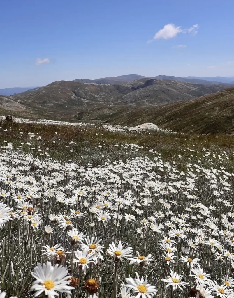
The Australian Alps are the real challenge, stretching over 655 kilometres from Canberra to Walhalla – this is where your ambition is going to get put to the test. You’ll be crossing remote valleys, high plains and multiple river systems on the Australian Alps Walking Track. Protected areas include the Alpine National Parks and Baw Baw National Park – but be warned, snow can still be around in early summer, and storms move in fast – ski resorts may provide an occasional resupply point, but during off-peak season, you’d best not be counting on them.
This is not the place to ask where the Great Dividing Range starts – you’ll know it when the weather turns sour.
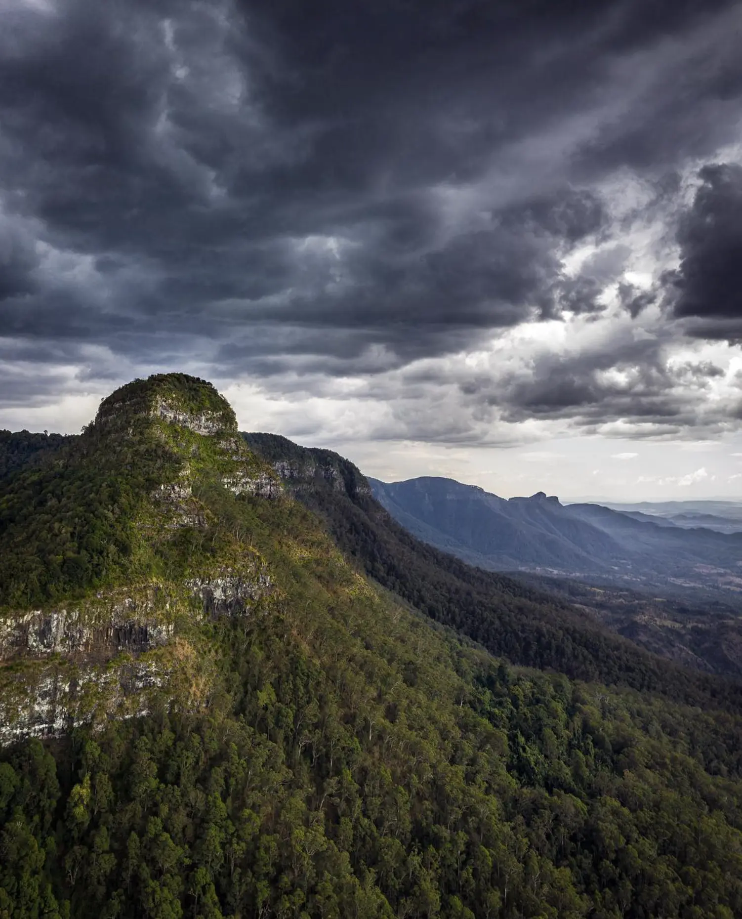
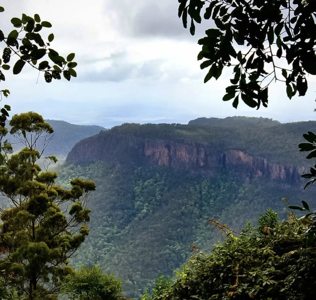
New South Wales to Queensland: Plateaus and Passes
Further north, the range breaks up into forested plateaus and dramatic escarpments.
You won’t want to miss:
- The Blue Mountains – so many great walks to pick from
- Main Range Track near Cunningham’s Gap – a real doozy
It was explorer Allan Cunningham who put this section on the map in the 1820s, scratching out a route that still shapes how we get around today. Be careful – the terrain is deceptively easy – you might find yourself lulled into a false sense of security before a steep drop or sudden storm comes along and resets your expectations.
In south-east Queensland, the Scenic Rim Trail is one of the few multi-day walks you can do through Main Range country that’s been properly set up for sustainability. Options such as Spicers Peak Lodge, Spicers Canopy, and Spicers Hidden Peaks Cabins demonstrate what can be achieved with care and thoughtful environmental consideration.
Wildlife, Weeds and the Reality of Track Infrastructure
You know, it’s not untouched wilderness out there. Spend any amount of time walking, and you’ll get a firsthand look at the impact of invasive species – think feral deer down in the south or pigs up in the north. And then there’s the track work you’ll encounter: stone steps, timber bridges – even the odd rock ladder or two. A lot of that’s there not just to spare fragile slopes, but also to keep you from twisting an ankle.
If you’re planning on tackling the gorge systems around Wells Cave or along the fire trails that can be accessed via Cerberus Road, then sticking to the formed routes is pretty crucial – especially if you want to avoid causing serious erosion.
How The Real Walkers Link The Range Together
Experience has shown that most walkers aren’t in this for perfection. What they do is use resources such as the Great Dividing Trail Network, regional maps, and the National Trail, where appropriate, to link the best bits of the range.
Some of the most popular combinations look like this:
- Goldfields routes merging into the alpine sections
- Walwa to alpine plains and on into New South Wales
- Blue Mountains plateaus linked with northern NSW escarpments
And you know what? Commercial operators – including companies like Wildlife Tours on some of their regional experiences – tend to support this sectional approach over trying to sell the idea of a single end-to-end hike.
Planning Realities You Just Can’t Ignore
Long-range walking here is all about logistics. You can’t just ignore the following:
- Water sources are pretty unreliable
- Fire and flood closures change on a weekly basis
- Private land boundaries can shift and change your route
Guidebooks such as the Goldfields Track guide and some regional Walk or Ride Guide publications can be a big help. But don’t get your hopes up – they won’t replace current park alerts. And if you’re looking at special offers for trips, be sure to read the fine print – seasons, group size and conditions all matter.
The Takeaway From Someone Who’s Been There
The Great Dividing Range isn’t something you tick off in one go. It’s something that’s worth coming back to. Walk a section, get to know it – then come back when you’re a bit better prepared.
If you’re still wondering where the Great Dividing Range is, it’s actually pretty simple: it’s everywhere to the east of the inland plains. And it’s a real treat for walkers who treat it like shared Country, not just some personal challenge.
FAQ
Is it actually legal to walk continuously along the range?
The thing is, you can walk legally on public land and approved tracks, but private property and restricted areas break up the continuity.
How long would a linked journey take to complete?
Expect months to years – depending on the sections you choose, the seasons and any detours you might need to take.
Are these walks harder than overseas long trails?
They’re definitely different. You’re replacing crowds and huts with navigation, heat, water scarcity – and a healthy dose of remoteness.
Do walkers need permits to do this?
Some regions and events require permission. Always check with local park people and Traditional Owners for guidance on what’s allowed and what’s not.
Is this suitable for beginners?
If you’re short on time or looking for a taste of what it’s all about, then short sections are a great place to start. But long linked routes? That’s a whole different story. That needs experience, fitness and a healthy dose of conservative planning.